
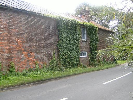
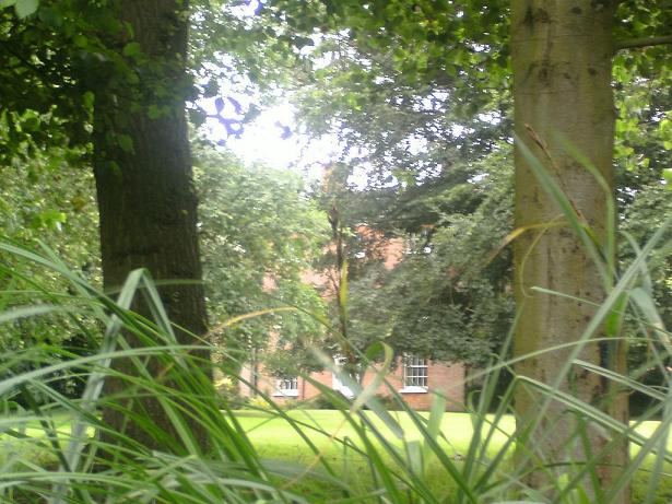
It was a golden afternoon and I was on my way somewhere else. I haven’t the foggiest where – and happened to be taking one of my typically meandering “short”-cuts across country through some cutesy Norfolk hamlet called Briggate. I was probably muttering some comment to myself under my breath, as I often do, rating it in terms of its attractiveness, when the trusty Transit hiccupped over a little red-bricked, humpbacked bridge of a certain age. Nothing out of the ordinary, I hear you cry.
And there isn’t. And I would have driven on, and possibly this site wouldn’t have been written, or written many years later, had I not randomly looked to the left as I bunny-hopped over the bridge and my stomach temporarily lifted my breakfast a few inches. What I saw caused me to slam on the brakes, totally ignoring whether or not someone was behind me in a large vehicle travelling at speed (unlikely as this would be in Briggate). What I had seen did not at first register, so I reversed, and looked again. A minute later I had stumbled out of the door in a frenzy and was sniffing around the place, wondering and asking questions of the air, and of myself. What I had found just didn’t seem right.
This was 2006 and now, four years later, I’m sitting here writing this with some very sore arms, having recently completed the canal by kayak – or, at least, completing it as far as Bacton Wood Lock, where the water really disappears. Thereafter, it’s been a matter of wading and walking. And I’m still as fascinated, indeed more so, by the North Walsham and Dilham Canal (I always call it the Dilham Canal, it’s snappier) than I was when I first wondered why there was a lock sitting in the middle of Norfolk, surely a county of dreaming slow rivers, gorgeous sandy estuaries and quaint villages in rolling farmland. To me, Norfolk primarily was the North Coast, and although I had been discovering its other beauties (especially the Broads by kayak) for some years, nevertheless I was raised in the industrial Midlands where canals are two-a-penny and the sight of one in Norfolk, land of beaches, farms, aristocratic country seats, no motorways and no real hills (except the Cromer Ridge), was a shock.
I’ve got over the shock, a bit.
But I’m still in love, yes in love, with the canal, as much as with the River Waveney, and for much the same reason. They remain, the two of them, the principal waterways in Norfolk that are (a) free and (b) free of motor craft – as the Waveney is above Geldeston. Two blessings which will forever endear them to me. Oh, and there’s a third; they are both rhapsodically beautiful, in very different ways. But whereas the Waveney is a true country girl, honest-to-goodness, charming, sometimes willful and with an attraction for farmers and fishers, the Dilham Canal is Sleeping Beauty – a stately princess (of admittedly rather common origins) sound asleep behind her brambles, nettles, thistles, trees, reeds and grasses and waiting for her prince to come… if he can raise the money to save her…
Before I wax too lyrical for a slim volume, let me bring myself back down to earth with a bump by reminding myself, and informing the reader, of the canal’s origins. There’s already a slim volume written in 1977 when the canal was at its most forgotten; no-one had dredged or cleared any of it since the war department in the forties and the last (motorized) wherry, Ella, had travelled sadly down the canal in 1935.
This excellent little volume – hand-typed and with hand-drawn, very basic maps and drawings – is by North Walsham historian and teacher R.S.Joby and tells the story of the canal in an entertaining and informative way. Essentially, the trustees of a proposed turnpike road between North Walsham and Norwich met in 1797 to get the road bill passed through parliament. The road was built – and proved expensive for locals to use, as it was a toll road to pay for the expense of creating it. 8d (8 old pence to those, like me, born in 1971 or after) per ˝ ton per mile – the cost of a ton of coal doubling by the time it had reached North Walsham. The era of cheap road transport was still a hundred and thirty years in the future.
Actually, let me paint the scene a little wider, and breathe the heady air of the broad, sunny uplands of history. In the 1650s, land was divided up much as it had been for centuries, “since time back”. Mediaeval arrangements of land in villages were much as Chaucer had known them, and that in itself went back to feudal times and the strip farming system where freemen owned “strips” (long, thin fields to you and me). By the 1750s, lots of things that had stayed the same for centuries began to shift. Some have it that the wisdom of Greece and Rome, submerged for 1500 years by the Catholic church, finally began to overtake traditional mainstream Christian dogma; some, that the Reformation had a delayed knock-on effect in the advancement of science and medicine; yet others have it that the Knights Templar, destroyed in 1307, had “resurfaced” as Freemasonry and surreptitiously spread the “secret knowledge” of ancient societies through the landed, enlightened gentry – however you write it, this was the Age of Enlightenment and new ideas were in the wind: cultural, social, agricultural, and of course, and ever increasingly, industrial. The French Revolution and its sequel, the Napoleonic Wars, had shaken Europe (it has been argued that the delay in the creation of the canal was not just down to Norfolk roundaboutness, but the drop in grain prices after the Napoleonic conflict).
For a flavour of this you could do worse than read Winston Graham’s “Poldark” novels (although set in Cornwall, the parallels with Norfolk are striking), as I did as a child. In them you get the feeling of the old, more “honourable” gentry giving way reluctantly to the “new men” with their new technologies, bringing change in their wake – not always peaceably, and driven, as always, by money. Of the bright young minds engaged in exciting projects, dabbling with steam engines and pumps and new methods of doing things.
This is the era and ethos in which the Dilham Canal was born, as the age of the canal itself was already passing and the age of the steam driven engine and the locomotive were at hand. The first experiments in “horseless carriages” – automotive transport – were taking place, mostly with harnessing the power of water as steam. As the first spadefuls of earth were flying from the canal at Austin Bridge, George Stephenson was experimenting with what would become the “Rocket”, the first truly successful steam engine that would win the Rainhill Trials in 1829 and net its creators, George and Robert Stephenson, the contract to supply locomotives on the Liverpool and Manchester Railway. And landowners were asking themselves why they were not “improving” their land, increasing yields and pushing down costs. Rather than feudal overlords who owned land and were owed allegiance by working peasants, as they had been for centuries, they came to see themselves in this new, bustling, cost-obsessed world, as country businessmen who could increase the profit of their lands by clearing off common and old village land, enclosing it as pasture or arable land, and harnessing the new ideas and technologies.
To improve their estates they needed marl, lime, manure, bonemeal (all for improving soil fertility), coal, bricks and iron. The industrial revolution, to a midlander, immediately calls to mind Coalbrookdale, which needs a visit in person to get that feeling of raw, barely harnessed power changing the world – as it did. It calls to mind the Black Country of Dudley and environs, the canals, factories and quarries, the railways and glass makers, chain makers, brick kilns… all this is the historical iconography of the Midlands and the Industrial North, linked of course, by canals and later by railways. But the agricultural revolution was handmaiden to the industrial one and it was just as overwhelming in the East; the shape of the fields we see now is often not the shape of the landscape as it was in 1066, 1380, 1550, or even the Civil War. The “English Countryside” we see today, and cherish, is by and large the product of the Agricultural revolution. And the waterways were the first and most important arteries of this revolution, and it was the towns of Aylsham, Bungay and finally North Walsham who wanted in on the action they saw elsewhere.
And the story really begins in the town of Aylsham, because in 1773 they started building a canal – actually “improving” the River Bure, that delightful waterway known to tourists that runs through Wroxham – with a view to bringing wherries from Yarmouth right up to Aylsham Mill Pond. After delays, this went ahead and was built for around Ł7,000 for nine miles. Not bad, actually, for the creation of five locks, at Coltishall (still there – you can walk across it, behind Horstead Mill ruins), Buxton Lamas (filled in but you can kayak into the bottom of the channel), Oxnead Hall (you can walk past this one too by footpath from the road from Brampton, or the other way from Buxton Lamas), Burgh – the lock pond is good for a swim -, and lost in farmland just below the A149 near Aylsham itself, well hidden in the choked up dead end of the old canal cut but well preserved when you finally reach it. After the catastrophic floods of 1912, this “navigation” was abandoned as the cost of repairing the locks was too great given the fact that river transport was in decline anyhow, sapped by the railways in the latter part of the 19th century and then being steadily overtaken by road transport. If the floods had happened some thirty years earlier, the money may well have been found. The Dilham canal was also damaged but, strangely, was patched up and cleared for another 23 years of life.
Bungay too had put itself on the Broads map with three locks - at Geldeston, Ellingham and Wainford.
The Geldeston one is still easily visible from the “Locks Inn”, and the Ellingham Lock can be glimpsed in much
altered form from the Mill pool road. The Wainford one is the wildest, largely choked with tall reeds; however
you can see the chamber and the telltale curved shape of the lock pound (as it is at Geldeston) from the road,
and this can be hacked into.
However the call for
river transport to Diss and Harleston evidently was not great and the demand was not sufficient to warrant the
expense of improving the river further up with more locks. The Waveney is a fairly gently falling, and adequately
fed river already classed as a navigation to a high stage in its course, but it would still have required locks
to reach Diss by wherry – probably at Bungay, Earsham, Wortwell, Weybridge, Mendham, Brockdish and Scole – in
other words, the places where there are Mills and weirs. It could have been done – but the demand was not there.
North Walsham was desperate to follow Aylsham’s example, and after the poor usage of the toll road, it was decided after much discussion – on 16th December, 1811, at the King’s Arms Inn, Walsham, to build a canal, as an “improvement” of the River Ant but, unlike the Aylsham route, actually cutting out some sections of the river and building new “cuts”. Joseph Cubitt and Thomas Bell were already trustees of the turnpike, and saw that the road and the canal could in fact complement each other, carrying different goods. There were 57 trustees in all at the meeting (they are all listed on the first page of the 1812 Act). One of the principal aims was to reach Dilham Mill by a better route and bypass it; today Dilham mill is a lost, crumbling block of masonry sitting on a small stream, and the lake beyond it has vanished so completely you would never know it had ever been there, but for the incongruously remaining name still printed on modern OS maps- Dilham Broad.
There were some interesting points that suggest it was a doomed venture, right from the start. First, the canal was originally planned to provide North Walsham with a waterfront, as Aylsham had, so that it would be a true Broadland town with a dock (Odd, isn’t it - today neither town would spring to mind if you thought of the Broads – both are well outside modern Broadland). It was planned first to go to Lingate/Lyngate common and then another plan in 1818 had it coming to “Brackenbury Folgate”, presumably near where the industrial estate of Folgate in North Walsham is today; this would make sense as it would be the closest it could have reasonably got, as there is a small valley with a stream here – whereas the rest of North Walsham is on a hill. As you can see from the map of the canal, when it was built the nearest it got to North Walsham was Swafield. On this count, it was a failure before it was finished.
Secondly, we are talking the same length as the Aylsham navigation, about nine miles, and one more lock (actually only four were planned at first). Yet, compared to Aylsham’s neat Ł7000, the Dilham Canal cost Ł32,000 to build – more than four and a half times as much. Interestingly, the Act passed in 1812 allowed for the investors to raise Ł30,000 so it was not a case of going wildly over budget.
Clearly its investors thought highly of the enterprise, despite the very slow gestation of the project – 1810 was the year the scheme first saw the light but the first meeting was held in 1811, the act passed and printed 1812, the plans not drawn up until 1815 with another plan made in 1818. It was actually on 15th December 1824 – thirteen years minus one day since the original meeting – when at last the resolution was taken to build the canal straight away. The number of “bankers” from Bedfordshire (why there?) varies in reports, from “three score” to 100 to 150, but once they got going they dug most of the canal in about a year and a half. The first wherry got up to Ebridge (also known as Eastbridge) on 14 June 1826.
From this moment, the canal was unofficially open, but the very grand ceremony to open the whole thing came in 29 August 1826 and gives a flavour of how this sort of thing was viewed – and also how important it was to the town. I am not sure if even a new motorway cuts as much ice these days; or perhaps we are all just growing cynical, and take things for granted. Try and go with the flow – this was probably the most exciting thing that had happened in North Walsham for a long while and was for many no doubt a matter of intense pride.
In any event, the canal was opened with the “national colours displayed on the Market Cross and principal Inns [of North Walsham]” and the bells of the town ringing “a merry peal”. A fleet of vessels led by various notables led its way up through the first three locks and then “lay to on a beautiful piece of water on Col. Partridge’s land” – presumably, having done Honing, Briggate and Ebridge, this was near the land of the man who would own the canal in later years before its decline, Edward Press. Having returned from “that beautiful stretch of water” only today with arms burning from nettle stings, bramble rash and reed cuts, I wonder just what it looked like then, with “upwards of a thousand people afloat” and a band playing “national airs”. It was a genuine Norfolk holiday and for those who had sunk their money in the canal, as well as the millers and farmers who would benefit from the cheaper tolls, it must have seemed glorious indeed that their little market town of North Walsham was at last, parvenu though it was, part of Broadland. The victory parade ended with the fleet laying to above Swafield upper lock, and there was, according to an article quoted by Joby, the intention to “establish an annual water frolic” here – something which cannot fail to make one wonder today, as this same stretch is now a bleak, dead straight arrow of reeds and weeds where the water is not even in its original bed. In addition this section now has a distinctly forlorn, scrubland-ish feel – impossible to imagine as the ideal location of a “water frolic”.
But despite the high hopes and carnival opening, the canal was beset with problems from its earliest days. Upkeep came out of the tolls which were not charged for being on the water, but based on tonnage alone, and the returns were pathetic. A few hundred a year, for a canal which had cost Ł32,000 to build. The Ant dropped some 48 feet from Antingham, its source, to Dilham; and the canal began to silt not long after it was created simply because there was not enough flow to keep the water clear. The depth of the locks at Briggate, Bacton and especially at Ebridge makes you realise just how far the canal had to drop, considering this is Norfolk. Also remember, at Antingham you are only a few miles from Trimingham and the North Coast – at Dilham, the water is tidal. Steam pumps had been envisaged in the grand plan, and mentioned in the Act… but like other things in the original scheme, this idea had been ignored.
More notoriously, the canal also had irregularities in its management. Arguments between Mill owners and canal users created problems - Press was not supposed to serve on the committee according to the rules of the company (See Appendix I, The Act), but did so – the treasurer tasked with issuing shares in 1866 ran off with most of the money – and even odder, as far as anyone has been able to ascertain, the canal company has never been satisfactorily wound up, but most of it rests nominally in the hands of the successors of the 1921 shareholders, Messrs. Cubitt, Walker, Savill, Shepherd and Faulke who were named as shareholders of Ł500 capital. They had bought the canal back from a London group who had taken control in 1906 at Press’s death. Today, the names of Cubitt and Walker are still visible [1]

on their Mill at Ebridge, which was their headquarters when they owned the canal, but which, like so much else on the Dilham canal, now lies derelict. Interestingly you will recall it was another Cubitt who, as a turnpike trustee in 1811, had been behind the canal’s creation, and as a further point, the winding gear for the side sluice gates on the canal is embossed with the name “Cubitt”.
A group called the “Old Canal Company” are supposed to have recently bought the top two miles or so, while the rest is still in the hands of those who owned it in 1921. But, let’s be honest. Put your canoe or kayak on the canal above Honing Lock and you will soon realize that, really, no-one owns this river, man-made or not. I have seen: in an unexpected gap in the trees near the Weaver’s way, and up near the Swafield railway crossing, two agricultural water pumps, bringing water to the fields in summer, and one fishing hut near a farm south of Briggate Lock – and of course the Oaks Farm at Tonnage bridge near the start of the canal. And that is all the civilization I have found on the canal apart from what is clustered on the sides of the roads and bridges at Briggate, Spa Common Bridge, and Swafield. For the rest, it is as wild as you can imagine, deserted, unwanted, unregarded and unfrequented except for the fish – even herons, the sentinels of the Waveney and other Broads rivers, weren’t much in evidence (they probably flapped a mile at the inordinately loud sounds of my progress as I stumbled though the reeds). A partridge, a pheasant – maybe some kind of waterfowl I don’t recognize flying up in front of me, startled – and that was it. Not only not a soul, but no trace of a soul either. So that’s the reason it was made, and the reason (or lack of reason?) it’s still there. For the remainder of the book, I will take you through the canal a splash at a time with as many photos as I think you are likely to be interested in. NB: some of the sections were done North to South i.e. downstream – this was not to be perverse but because access points sometimes determined this. And it’s more fun that way.
I - Honing to Briggate Lock (Done northwards)
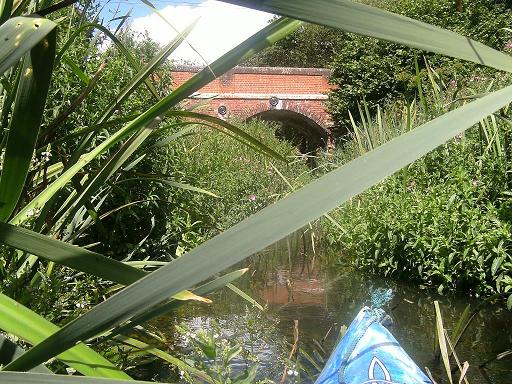
This is best done on top of the (fairly) well-known, beautiful stretch from the canal’s mouth at Wayford Bridge, where there is parking (if you get there early – otherwise drop the boat and go up the road and park then return. Beware - they are getting stricter on having a Broads licence to enter the water, though (a) day permits are available from Bank Boats opposite you and (b) it is in any case a matter of a few hundred yards to the canal, so it seems a bit cheeky to charge for this – I leave it to your discretion!).
The original aim of the canal is best quoted straight from the excellent East Anglian Waterways Association website, at present the largest web authority on the Canal and the best source of photos old and new, including two of the earliest sketches:
“Prior to the canal being built, the River Ant was navigable up to the tail of Dilham water mill, which was situated at the southern end of Dilham Broad (also known as Dilham Lake) and not far from the present day Honing (Dilham) Lock. The River Ant was an ancient navigation, but northward from Wayford it took a somewhat roundabout course, including a big meander to the east of the present canal. This section was also probably fairly narrow and shallow, but its course can still be traced on the map today. In 1810, the promoters decided instead of starting from the Navigation at Dilham Mill, to bypass the loop, with a new cut running several hundred yards north of Wayford Bridge, and improve the remainder of the route up to Honing Lock, which needed to bypass Dilham Water mill.”
Dilham Lake is shown on the 1885 map of the area as a marshy blue shaded area, presumably very shallow water interspersed with tussocks and marsh, to the west of Honing Lock and separated from it by an area of wood and marsh (still there today) and a curious arrangement[2]
whereby the lake, bordered by the old, low walls that are still visible at the edges of the field, had an overflow spillway (above) into a secondary channel that came back to the mill.
Today the lake has vanished entirely. It must always have been very shallow – indeed today the area looks just like any other field, complete with established trees, and moreover it looks as if it has always been so, enough to fool me on a first visit. Yet even on modern maps the designation “Dilham Broad” has survived. Peculiar - when Antingham Pond, at the other end of the canal, is very much a broad to look at in every detail – yet is designated a pond! Today the only water in Dilham Lake is a stream on the east side that still comes down to the mill, but the spillway that once vented the lake is now high and dry, about three feet above the level of the stream[3].

Looking at the other two sides of the field, you do ask yourself: if this was a lake, how the hell did the water stay in?? I think the answer is simply to look at where the two walls were built, south and east. The land – however flat it looks today – must slope gently towards the south and east sides, hence the need for the two walls; the mill took the water off at the deepest point, the south-eastern corner. At the north and west fringes the lake must have been only inches deep. The fact that the Honing road does a sudden and unexpected sweep to the left shows also that the Broad, at times, could swell to larger proportions – hence the need for an overflow.
The “overflow” spillway is still visible if you hunt around in the woods and this fed into the stream that is still extant, and which came down to the (now ruined) Mill at (OS ) [4].
Imagine if you will that before the canal was built, wherries could get reasonably close to the south side of Dilham Mill, by sailing up what’s referred to as the Mill “Tail”, i.e. the outflow stream [5].

This channel now leaves the canal at (OS ) by a footbridge – interestingly there was a footbridge marked on the old 1885 map as well at this point. So the first big section of the canal was built to (a) shorten and deepen the Ant by cutting out the large eastern meander, and (b) bypass the Mill. Interestingly, the shallow lake was created by building the walls you can still see (the eastern one is rather more crumbly and difficult to see), but after Honing lock was built, this actually became the access to the mill, from a point above the lock, and the tail channel fell into disuse.
A small footpath leads to the ruined Mill from the lock. Modern footpaths also take you across the eastern meander, the old Ant, at (OS 344 273) and (OS 347 270).
I have not included a description of the lower part of the canal form Wayford to Honing Lock, although the Smallburgh arm, off to the left after you go under the A149, is the first “Arm” of the canal and a very beautiful and interesting (if very well known) section, but motor boats are allowed here so it still has a mainstream Broads feel.
Reaching the end of the right fork of the Smallburgh arm (Tyler’s Cut), you can see a reconstructed Dilham canal style bridge, marking the end of navigation – this arm stops just above the bridge. There is a tiny dead end footpath leading to the other end of this fork. Eventually this other arm becomes a wooded stream that can be glimpsed from the A149 as it crosses it. NB: if you want to do the Smallburgh arm then you really should be licensed as this is proper Broads jurisdiction, just as the right turn out of Wayford cut is, leading to Barton Broad and the rest of the Broads.
Anyhow, if you continue straight on and out of the Broads jurisdiction into free water you begin the journey proper with one of the loveliest (and easiest!) bits of canoeing on the canal, a wooded but very straight section. The old course of the Ant leaves the canal at the little sluice building on the east bank, just as you emerge from the first wooded section into fields.
Shortly afterwards, you see the first structure on the canal - Tonnage Bridge (OS 347 263), which collapsed in the 80’s and was rebuilt – and very well, too. It appears to do nothing but give access from Oaks Farm to the fields on the other side but I gather the story here was similar to that at Ebridge and Royston Bridges – the distinctive little Dilham-style bridges, designed for horses and carts, were not up to the challenges of 20th century agricultural machinery – there is a photo of the collapse. Interestingly there is provision in the act that estates larger than 10 acres should have a "swing bridge" to join the sundered lands together. Royston and Ebridge were rebuilt before this could happen (Royston being lowered to carry the Bacton Gas terminal lorries). Also Interesting is that neither of the two railway bridges of much later date that cross the canal, at Briggate and at Swafield, are still standing, whereas eight of the nine Dilham bridges, Smallburgh, Tonnage, Dee (Honing), Briggate, Ebridge, Spa Common (Bacton), Royston, Swafield and Bradfield Bridges are all more or less intact, only Royston having been altered beyond all recognition.
Some way after this there is a large pool and the Ruston arm, the longest of the canal’s “arms”, goes off to the right, heading for East Ruston – you can follow this although shortly before its termination it goes under a decapitating bridge and enters a pool of sludge – don’t make your boat disgusting by going any further, there isn’t any point as it stops around the corner! This however is in fact the return of the old course of the Ant, that great meander out eastwards that the promoters of the canal took such exception to.
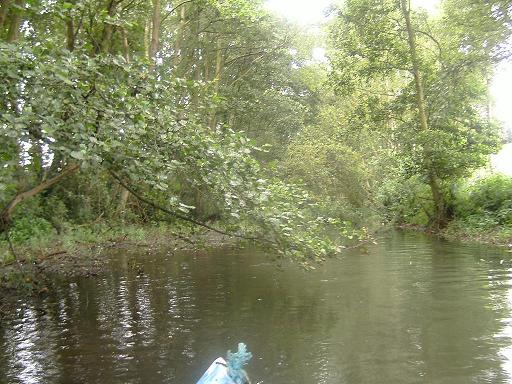
Honing lock, though the most well known, remains one of the most beautiful locks on the canal. Paradoxically it is the only one apart from Swafield that cannot be easily reached by road but because of this, despite the footpath access and the fact that people can reach it by day-hiring from Bank Boats at Wayford, it retains that lost feel that Bacton has itself lost on account of being rebuilt, and which Swafield retains so admirably. Discover it for yourself – Honing appears after a magical wooded section that answers the canal’s beginning, and as the waterway narrows and becomes a lot reedier after the Ruston arm departs eastwards, you may well find – except on a warm Sunday – that you have it to yourself. Look carefully in the water to your left as you enter the lock – the mighty lower doors are still there in the water -and some of the bolts/nails still protrude from the rotting timber, so mind the bottom of your boat! Do stop off to find the ruined watermill and vanished Dilham lake mentioned earlier; shortly before the lock on the left there is an obvious landing place. The towpath through the woods below the lock is in any case just gorgeous – follow this and as soon as it leaves the wood, take the footpath off to the right across the field – the Mill is just inside the trees on the far side.
To the west, between you and the site of the vanished lake, is something I would describe as a primeval swamp forest of great beauty. Dragging your boat up next to here takes you to the lock head and an even more obvious, delightful little place to put back in above it. All seems calm and peaceful, inviting you to go a little further…hee hee. Don’t be fooled. The Dilham canal left me with a lot of scratches, cuts, bruises and so many nettle stings my arms and legs felt they wanted to get up and crawl away from me in the evenings!! I also wouldn’t count on getting it all done in a day. The section from Ebridge to Briggate took four and half hours to kayak, and this was on my second attempt when some of it had already been hacked. I then returned on foot over the fields to my van at Ebridge – covering the same distance in a little over 30 minutes.
But if you take the challenge, the first section is deceptively mild, and beautiful too [5a]
allowing you to reach the Honing Bridge (also called Dee Bridge on the 1885 map) in a short distance, after which the Canal volunteers have done a splendid job on clearing out the short but lovely Honing Staithe, off to your right. They’ve also laid out a little walk in the pretty wood next to it. The staithe is still very shallow and silty but you can now see the disused railway line running more or less right across the foot of the staithe.
Emerging from the staithe and turning right (upstream), you accept the perils and delights of the rest of the canal as far as Bacton Wood Lock, which is the remainder of the watered, navigable section. Be warned: I use the word ‘navigable’ in its widest possible sense. This section has not been cleared or dredged since the war department were here in 1940, 70 years ago - and it shows!
Not far after you leave the staithe you come in for some pretty low-hanging trees and thick reedy sections. The going doesn’t seem so bad until you come to a tree lying right across the river. The best thing is to dig the boat hard into the left bank and get out on to the tree, pull the boat over and get back in. This tactic will come in useful in the next section!
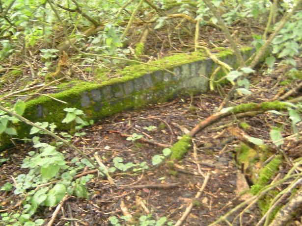
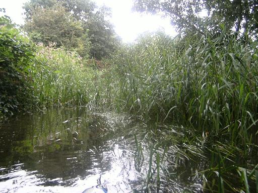
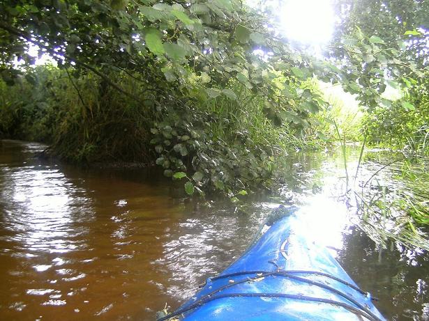
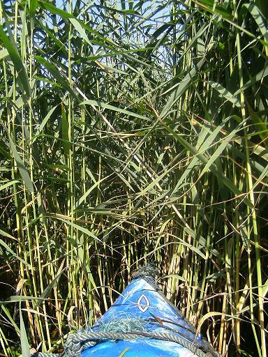
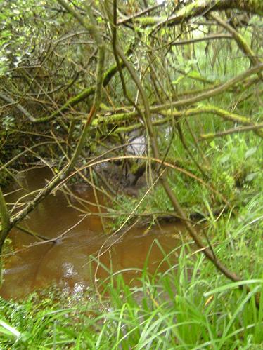
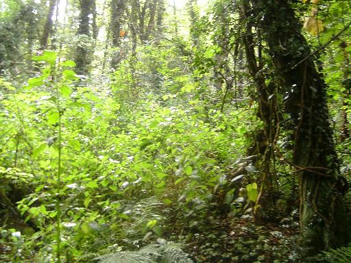
In fact it is the reeds that will really slow you down as you approach Briggate mill; you get a feel of being out in the fen country but you can’t see much of it [6],
except the tops of some trees over to your left. There are some gorgeous opening out stretches but hard work is required to get you to the section at the end, heralded by a meadow and the unexpected sight of a fishing hut on your left, at the point were a neat, maintained little side stream veers off. After the hacking and bashing, this almost seems surreal. This goes off to Briggate farm.
After the field disappears from view you go through a longish open section which appears to end in more difficult, high grassy reeds and the passage appears to be confused – this is where the old mill stream went off, again to the left (you can see this on the OS map at 316 274). There is a dyke to the right as well. I tried the mill stream but it appears just too choked up, and you can see how much if you reach the Mill from the road[7].
There is a similar problem if you attempt the little square circuit and quarter-circle of the Briggate arm immediately above the lock to the west[8],

just north of the road; the small staithe is now just reeds, bordering the road, the arm has actually been locked off and the channel to the staithe is so muddy and shallow that you won’t get along it in summer.
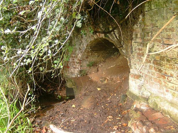
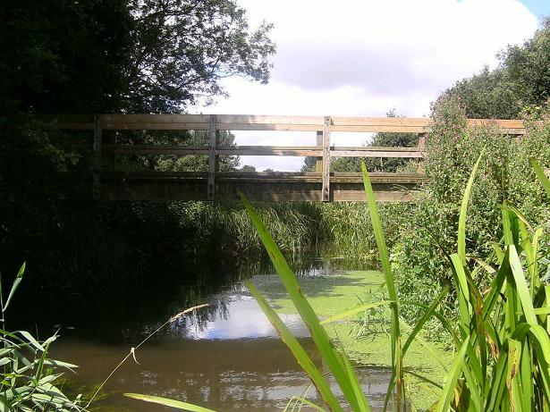
Continuing on the central way, you go through some more overhanging trees and branches and then a bridge magically appears in the trees and you know you have made it! [9]
(For a description of Briggate Lock and Mill, see the next section, heading southwards…)
II - From Ebridge Lock down to Briggate Lock (Done southwards)
Ebridge lock itself, entered from the road (south side of the bridge) is possibly the deepest of all the locks. Peering over the side is certainly a scary business. The little upper gates are still in place, giving you a feel for what the locks looked like when closed, but much of the timber has rotted away except for the frames, not surprisingly.
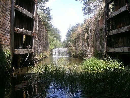
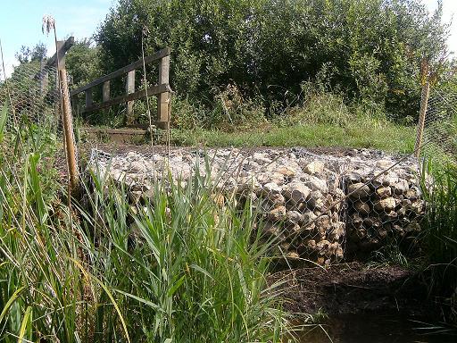
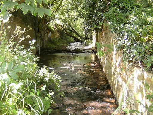
The water in it actually appears to be very shallow and easy to enter on foot, as Briggate, Swafield and Honing are but attempting to do so you find yourself sinking in about two feet of silt and mud. However although very much choked up with weed the lock can be entered by boat and at the end there is the customary deep pool shared with Briggate and Swafield. There’s some rubbish (old bike etc) in the water but the bottom appears to be firm and presumably good for a swim [10]
See cover picture
- if you can find some firm ground on which to leave the boat!
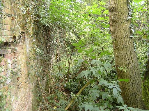
Ebridge Mill was the last headquarters of Cubbitt and Walker, originally of Briggate, and after the disastrous and deliberate fire there in 1975 Ebridge was their main mill. Now even Ebridge has succumbed to time, although as you can see [11]
this has not happened too long ago.
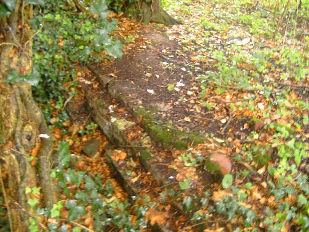
The Mill channel [11a] can still be seen quite clearly on the south side of the building and detected on the North side although it becomes sludge long before it gets back to the canal, though its opening is discernible, just, from the canal side. There was also a Dry Dock built here in the 1880s, which was “opposite the Mill” – this is difficult to place now given all the undergrowth, but a clue may lie in the steps and wall visible on the left side of the bridge as you take your boat down to the water.

There is no evidence of anything answering that description anywhere else on the Mill site.
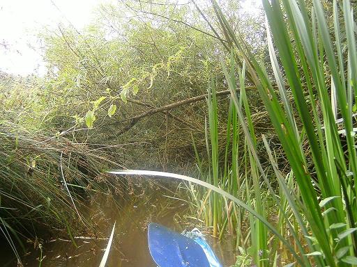
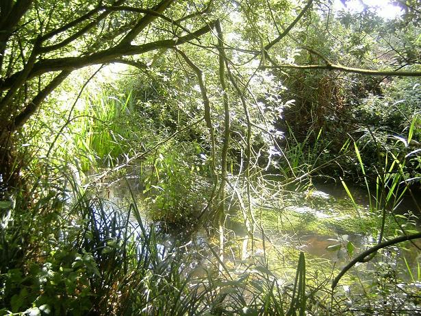
Coming out of Ebridge Lock under the rebuilt bridge, the going seems relatively easy and although some ducking and weaving is required, the canal soon opens up into a broad stretch with pleasantly overhanging trees and much waterweed. There is a fairly open feel to it as it goes between fields and it has occasional stretches where it narrows and has high reeds and grass to push through.[13]


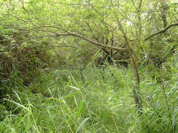
After a while however the canal begins to alternate between areas of what I came to term “gateway trees” that have all but blocked the way with their profusion of branches, and stretches of very difficult tall-grass-enclosed waterway where it was necessary to force the boat through by quanting with the paddle or just rolling and thrusting, or grabbing bunches of reeds and grasses. Ironically it becomes possible to actually see the farmland on the left hand side at times, particularly at the “gateway” points, where it sometimes seems as if it would be easier to climb out onto the steeply sloping bank rather than force your way onward through the mass of branches. [14]
After a couple of breakouts into thankfully wider water, the canal has a definite little stream joining from the right. This is the stream [15]
at (OS 308 284) and it closely ghosts the route of the Meeting House Arm, which came from the chapel [16]
and hamlet of Meeting Hill a short distance to the west (the chapel has a founding stone on it saying it was founded in 1829 – 3 years after the canal was declared open, and lies almost directly at the end of the arm). However immediately after the stream joins, the canal goes through one of the two most difficult points on this section, indeed on the whole canal, being blocked with a seemingly impenetrable wall of branches and foliage and requiring a fair amount of breaking and cutting to get through. It is impossible to see any trace of the entry of the arm from the canal on the right. The arm itself – if you can get to it overland, it’s guarded by muddy dykes – is simply a reed-choked channel, like so much of the upper canal.
After this the canal becomes a little easier as if to compensate – but this only lasts until it reaches the parallel bank of woodland on the left bank of the canal. Two sections of this are now designated access land under the CROW act of 2000 but at the time of writing, there appears to be no access from the land! The most obvious route, a farm track, to Corner Common Farm, is designated “Private” and the only access does appear to be from the water – although in summer this is likely to involve being stung quite badly to cross the bank and parallel ditch. The woods are pleasant and are like a kind of fen pastureland, with worn paths – presumably animal – leading to and from the water. Is this land accessible from the water because of the canal? The 1885 map provides half an answer – that this land was originally accessible via a footpath from Gage Farm (now the holiday cottages at OS ),and was known as “Old Corner Common”. While the path down their drive has survived, the other, dead end path to the common, has vanished, leaving the access land high and dry, strangely accessible only from the canal. I recognise that some kayakers would take issue with that definition of “accessible”…
The going gets much tougher in terms of trees and bushes now, and low branches that must be limboed under become much more frequent, with the necessity of taking a run at some of them in order to “fly” the boat over them and out of the water. At three places it became necessary to leave the boat completely and balance over a branch or tree then re-enter (not the easiest of processes as the banks and bed here are nothing but thick, deep mud). Beautiful as this section is, it was with relief that the pillars of the old viaduct of the dismantled railway (Melton Constable-Aylsham-North-Walsham – built 1881, Yarmouth & North Norfolk Railway, closed 1959) came into view through the dense foliage! This crosses on its way to Stalham and on to Great Yarmouth. If you can get out on the left bank, not far off the canal here is the Weavers’ Way car park – a good place to park to get the boat on the canal if you don’t mind carrying it a short way/have wheels, and also the ruins of the old Honing station (actually at Briggate). This is also a good, if roundabout, way to continue if going on downstream as it gives you a way around the lock.[16a]

16a
16b
16c
If you continue downstream past the viaduct there is a delightful short stretch with much waterweed and flowery banks, but watch for the mill stream going off to the right/west [16c], almost entirely silted up. At this point you should be able to see the approaching drop of the lock [16b]– I really wouldn’t attempt to shoot this, at time of writing it is a vertical drop of about six foot - I am sure some would, but I reckon it would hurt!! The end of the lock at the bottom is deep enough for a swim if you approach it from the other side of the road bridge, and if you stand in the deeper water on the left side you can feel what I am sure are the upper (smaller) gates of the lock bouncing under your feet, still down there at the bottom of the fall pool. These gates, unbelievably, were still fixed on the lock as recently as the late 1960’s – see the Norfolk Mills Website for a photo.
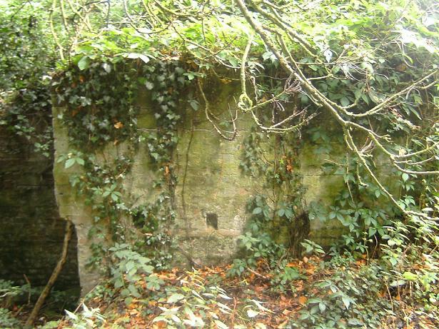
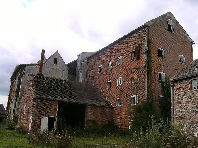
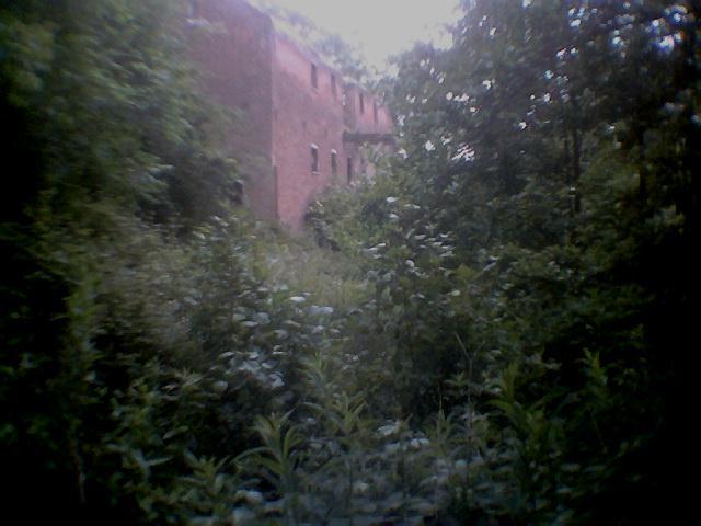
Briggate Mill – actually Briggate comes under Worstead – was once a huge building (again, see the Norfolk Mills site for copious pictures from its early days right up to 1975) and the low walls that border the road were the brick foundations of a huge timber, then corrugated iron building that dominated the village and faced a staithe for turning wherries. Looking at old photos, it makes you think of what Ebridge looks like now, and like Ebridge, it was also owned by Cubitt and Walker.
But both corrugated building and staithe have gone, leaving only the “granary”, the brick-built building behind, with its two opposite loading platforms, now gauntly staring at the sky. It was burnt down in the 1870s and, weirdly and deliberately, again in 1975 as part of a scam that had gangland connections. It was a sad end to the mill’s history - there had been one here for some 200 years.
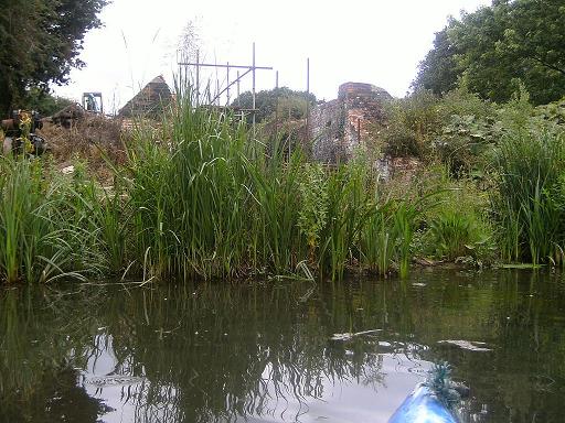
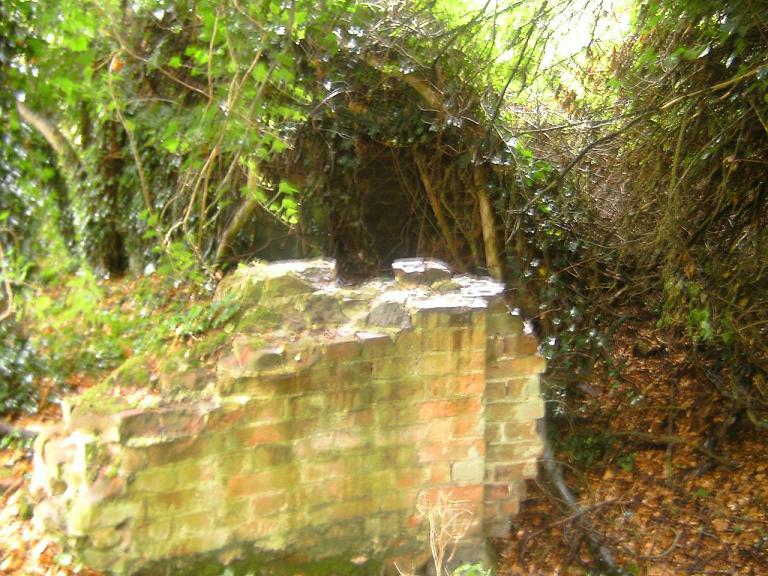
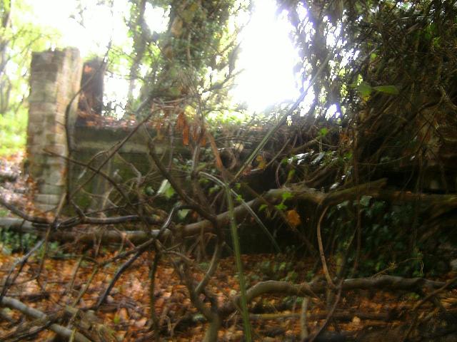
When I first found Briggate Mill on that magical hot day, it lay beautifully hidden in a riotous mass of foliage (see photo) [17].
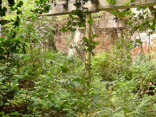
But an attempt to “land-grab” this, successfully opposed by the villagers, resulted in some clearance which means that despite the loss of mystique the mill can now be approached and even looked into although do beware, the brickwork and especially the loading platform arms on the outside are in a very precarious state and I would advise anyone to look inside from the entrance rather than attempt to enter.
The view inside in summer, however, is a riotous profusion of overgrowth winding amid the old pillars [18].
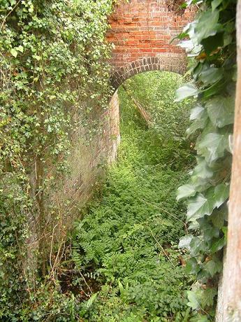
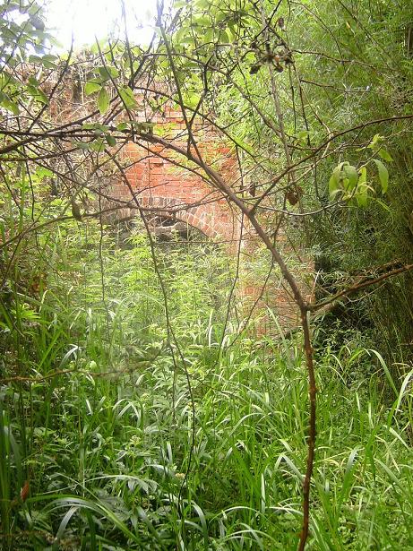
The loading channel/wharf can be seen just below the old loading platform and hoist (one arm of this has fallen, and is lying in the undergrowth) – to your left the mill stream disappears into an archway with the remains of a sluice gate visible. [19].
This, of course, connected with that arm you saw off to your right on approaching the lock. There’s a similar arrangement at Bacton, on the other side.
The Briggate arm [20]
was a quarter-circular channel whose terminus lies deeply buried in the trees and marsh just opposite the mill, and next to the village houses. It requires a fair bit of hacking to get in here to see it (you may also find the wonderfully ivied Pillbox, a tailor-made kids’ den if ever I saw one). The channel is still watered except at its extreme end where it is nothing bud mud and nettles, but someone appears to have made a little lake out of the other end of it [21],
while cutting it off from the canal. The secondary channel into the staithe is still there, but too shallow to kayak into -see [22].
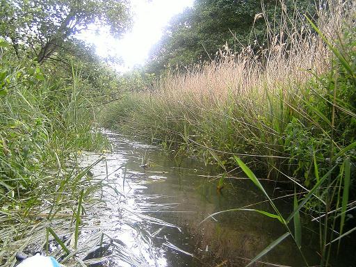
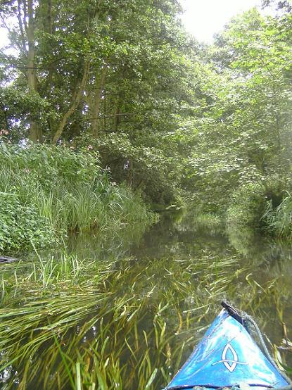
I found this is the easiest to access of all the sections, and at the beginning, thanks to the dredger Weasel, it is also appears to be the easiest to do. For a long while the canal has a narrow but clear channel running down its left (west) side, which apart from brambles and nettles is fairly easily navigable… but after a while reeds begin to press in.
Reeds aren’t too bad, by and large: they break easily and push out of the way (although the drawback is that they can fluff back into shape on your return so that you are not always sure of which way you went. They’re also mercilessly sharp). The early stage of this section has a rather lovely line of trees planted regularly on the right bank of the canal. They do not look 200 years old so I have little idea who planted them, but they are a feature all the same.
Grass, on the other hand, has filled a lot of the canal here and it is the tall grasses that can slow and stop your boat. A long section of grass meant that all I could do was grab handfuls of grass and pull – and after you have been doing this for a while, it can take its toll on the arms, shoulders and back! Paddling with your hands is often good, but wear neoprene gloves.
The grass continues for a fair way, then starts to be punctuated with small water-loving trees that provide welcome relief; although this called for secateurs and saw on occasion, nevertheless the trees here are less “gateways” than “rest stops”.
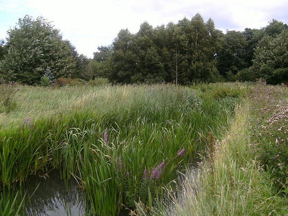
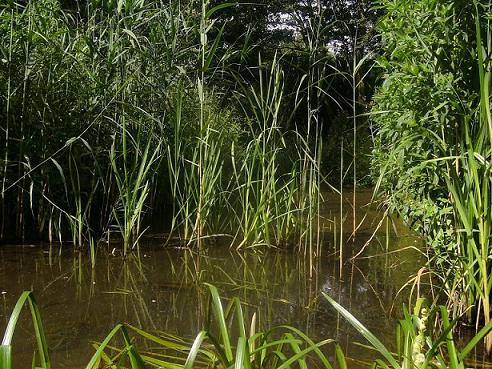
There are several of these pleasant “tree pool” stops but by and large the keynote of much of this section is tall grass [23].

It may vary depending with water depth, but unlike all the other sections of the canal there are no broad “opening out” bits on this section; it’s grass, grass and, oh my God, more grass… and then grass so thick that, in the end, there was nothing for it but to climb right out and, like Humphrey Bogart in The African Queen, haul my kayak over the reeds, knee deep in uncertain levels of mud and water. Basically, the reeds are so thick here that, eventually, they can carry you.
A landmark to watch out for is the crossing of the overhead telephone line. At this point you are not a very long way from Muckle Hill Farm, which I could actually see at one point where a fallen tree had blocked the passage. While having to get out and pull the boat over, I also had a quick climb up on the east bank, easily reachable, and saw a quite old red-brick building nestling in the trees to the west. This was the home of Edward Press, the Walsham Miller, who bought the canal in 1866 and began the first moves to tourism by buying a fleet of five wherries and converting some of them for passenger transport, including, I believe, pianos. There was a footpath marked on the 1885 map and on my modern OS map that went to Press’s Farm – but appears to be there no longer. There’s just an impenetrable hedge.
It’s very much a case of choosing your own route on the latter half. The reedbeds sometimes have no clear channel and it is a case of bashing through – and sometimes, of course, the boat just doesn’t want to go. All I can say is, take it slow and persevere, because finally, you will find yourself exiting to the right somewhere into a little clear section under some low trees and shrubs, and then – just when you think the reeds will go on for ever…. You burst out of them into the surprising sight of Bacton staithe, and find yourself looking at a very plain, unpleasant new brick house on the right and a rather more attractive cottage on the left. Just before the Lego brick house’s garden, look right and see a channel coming in through a tunnel – this is the return of Bacton Mill sluice that runs under the road. If the guy who owns the mill has his way, this channel will become active once more.
The staithe (I call it that, but it wasn’t one really) is pretty shallow and leads you under another humpbacked little Dilham Canal bridge, the Spa Common Bridge [24].

Once under it you are very close to the Bacton Lock but keep right in the trees, the channel is ever so shallow here. A few yards further on with the workshops on your left, you come to the split of channels just before the plank bridge that carries the “lost” public footpath (see next section) to the unofficial link of the patch of waste ground behind the workshops. The main stream going straight on in front of you is in fact the diverted stream that is coming to you from the sewage works near Little London on the outskirts of North Walsham; but it’s the little, almost missed, overgrown channel to your right that is all that is left of the otherwise much choked canal. By now the lock should be in sight - and it was with reverence, relief, exhaustion and exhilaration that I approached it, knowing that…. I had kayaked the Dilham Canal, as far the water remains in it!!!!
Like a number of other daft alumni (people who have stood naked on top of a mountain of 2,000 feet or more? etc etc) there can’t be an awfully large amount of us, so it does give you a buzz to be a member of such an elite and utterly insane band – together with the stings, scratches, bruises , aching back and massive reed-rash all over your arms, of course. But though it was/is the end of the truly navigable section, it wasn’t/isn’t the end of the canal. By no means.
Just to go that bit further – I pulled the kayak over the earth dam that blocks the lock (and which will be removed when the restoration of the lock is complete) and had a little turn around the foot of the lock, but the scaffolding sensibly prevents any craft from entering it at the moment, and the water is definitely not inviting enough for a swim.
Out of your boat, climbing up above the new lock top and turning around to face back downstream through the lock, you can see a dry channel off to the left (it looks like a sunken road) that was once the mill stream. Follow it a little and you can see where it goes through nice shiny new brick guide walls under the restored, lived-in Mill, all just ready and waiting to be used once more. It’s fun to visualise water in this again.
Above Bacton Lock you enter the dry section, where you can actually walk the bed of the canal quite easily. A railway sleeper-plank bridge lies across the new stream, where the water now comes in from the left, bending away from the canal shortly before the short arm that enters the lock – itself actually blocked with rubble and earth at the moment, as I’ve said above [25].
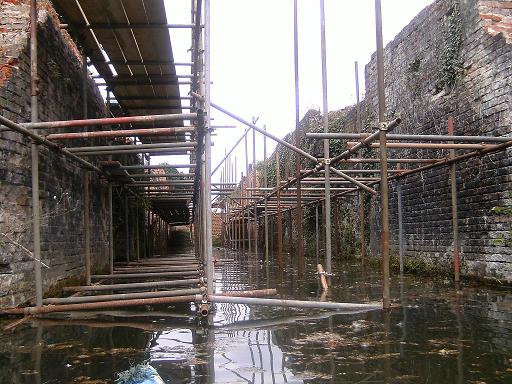
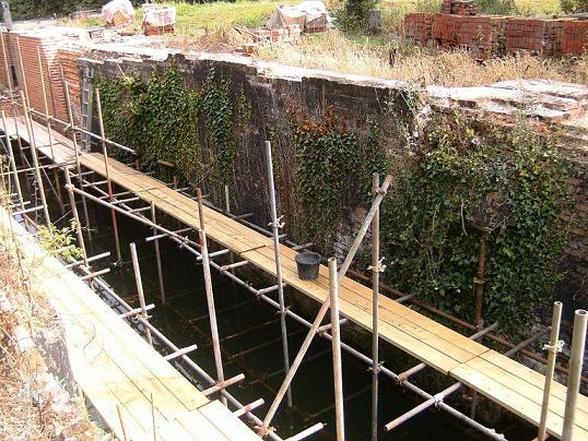
Bacton is an interesting case study. The owner of Bacton Mill has very laudably undertaken to restore this lock with a view to actually using it again, and this raises the notion of what will happen to the dry section above it, punctured quite deeply by the sewage farm culvert mentioned above? The new lock at the time of writing looks beautiful [26],
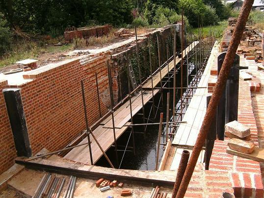
gleaming neat red brickwork and smart matt black winding gear, all faithfully and painstakingly copying the original and looking exactly like Briggate or Honing come to life. It’s so well done that there’s a vertiginous feeling of timeslip and you almost expect to see a wherry turn into the lock out of the corner of your eye, and see men in waistcoats and caps and corduroy trousers shouting to each other as they load corn flour from the mill or unload coal brought from Yarmouth, or work the doors on the lock. It is almost shocking to see the rebuilt section, because suddenly the canal jumps out of the Georgian/early Victorian past (before the era of photography so the earliest pictures of it are paintings and drawings) and into real, raw life. But it did raise a question in my mind, which will be discussed at the end of the book.
Going above, and leaving the water behind, you find yourself in the bed of the canal. [27]
You are now actually following a “lost” public footpath on the left bank that once led to the Wherry Pub (original name…like the one at Antingham, the Barge Public House? Hmm) at Royston/Austin Bridge, now a house with the same name. [28]
This section continues until you find your route rudely interrupted by the canal’s own water in a deep culvert to the sewage works. Believe it or not, the water, finding its way back from the sewage works, will actually CROSS the canal at OS 298 312 [29],

thence going back to Royston Bridge on the right/east side of the canal before doglegging back into the bed of the true canal at (OS 297 314). [see my map to get this clearer in your head]. – try and imagine the water at right angles, and flowing several feet above the level of the stream – this plays with your head a bit. After wading/swimming/flying or however else you manage to get over this unexpected chasm in the canal, you find yourself in thick veg at the top of the bank on the left hand side – there was no easy way through here and to be honest there is no trace whatever of the footpath, only the right on paper, and when I went, a bit of squashed grass here and there to show where some other idiot had tried to get through. Otherwise, it was another hack-and-scratch session! [30]
The path abruptly runs out of “right” at the southeast corner of private land and there was nothing for it but to return – or hop surreptitiously round the edges of the intervening two fields and out on to the road by the old pillbox near “The Wherry”, and going back eastwards along the busy road, cross the vanished Royston Bridge (now just a culvert next to the house [31])

and pick up the footpath that takes you north once more, up the eastern side of the still empty canal. You will soon see the new stream carrying the water come in from the right. Not long after this there is a distinct kink and a footbridge. This is where the water once more returns to the canal, and amazingly, it is still navigable above here to Swafield Lock, always assuming you can get a boat in here! A permissive footpath deviation that takes you to the back of Little London village actually dips down across the bed of the canal [32],
and then ghosts a dyke.
Over on the right is Pigney wood, a lovely little conservation area on the slope of the hill: and off to your left, and now followed by the permissive path just mentioned from Little London if you can find it from this end, a clearly visible arm/dyke to Little London, not included in the usual list of arms and branches… but probably because there is ANOTHER channel here, running parallel to the canal, on the west side, so that at this point there are three parallel channels, with the canal in the middle!
A note on the (now replaced) Royston Bridge, just left behind on the road. On modern maps it is not even named, but accounts of the canal repeatedly refer to either “Austin” or “Royston” Bridge. This sounds like one of those Norfolk anomalies born of a county where spelling and pronunciation remain – depending on your point of view – either horrendously confused or delightfully Chaucerian, but actually there is a very good reason if one consults the OS map of 1885, source of so much valuable information. To the west is “Royston House” – still there but now presumably renamed – and to the east, “Austin Bridge Farm”, now called “River Mount”. Aha. Mystery solved. Believe it or not, the map also shows that there was a staithe here, below the bridge. This, like all the other staithes, is now a mass of reeds with little or no water visible [33].
Bacton Lock was, like Swafield Locks, not attached to its nearby roadbridge and not directly feeding onto a staithe. The staithe, and public house for the thirsty wherrymen, were at Royston/Austin Bridge, accessed via that “lost” path which now makes you scratch your head and wonder how any wherryman, however desperate for a pint, would ever reach it (and returning squiffily to your craft in the small hours would definitely now be NOT an option).
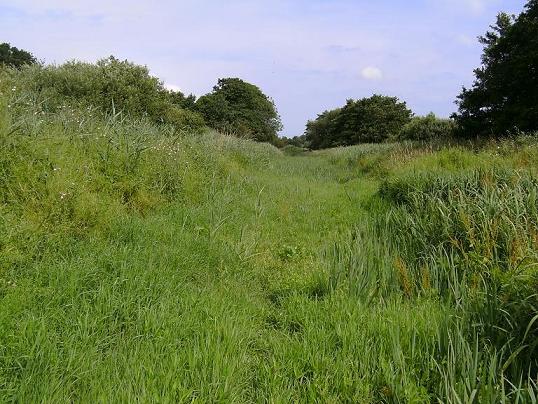
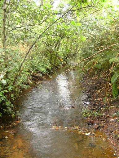
From here on to Swafield Upper Lock, the canal does not leave its bed and the water is actually navigable (though very reedy) from here up to Swafield lower lock, which after the 1890's became the official end of the canal. However the problem is access: the only really feasible place to get a boat on is Swafield Bridge, but the road is a busy one with no real parking anywhere near . There is a layby further on towards North Walsham but carrying your boat down to the bridge from here is very hazardous! It might be better if you want to see this section to do it the way I did – wading it, with shorts, long waterproof trousers and old trainers. By and large I found it had an average depth of between 1 and 3 feet. Make sure you’re fit and a swimmer – but if you’re neither you probably won’t still be reading this!
The friendly footpath following the canal below Pigney Wood gives you possibly the easiest bit of canalside walking on the whole route (there are some footpaths on the lowest section below Honing) but then abruptly says goodbye and swings away up to Pigney wood to the east and the only feasible (and legally permissible) way to carry on is to step off the new gabion [34]
and wade on up. This is a reedy section but actually quite fun to wade until you get near the railway line crossing, when the water gets a lot deeper, there are pools and the mud gets so thick that every step is an effort. If you can make it through, you burst out into the pond at the Paston Way footbridge [35].
This is the second of the canal’s derelict railway crossings (1898 Norfolk & Suffolk Joint Committee Railway, closed 1964) – always interesting to remember that when these were built, a smug air of modern superiority must have crossed the minds of the builders (this one doesn’t show on the 1885 map, for obvious reasons). Now, you can see two abandoned forms of transport side by side (or, to be literal, at right angles) and laugh yourself – or maybe pull a wry face as you think of the A47 in a hundred or two hundred years’ time, cracked and buckled with time and disuse, choked with weeds and bushes, signs mouldy and rusty hanging askew from their gantries, with the occasional aircar flying over it?? Ironically, there is more chance of the canal returning to life than the railway (although the railway has a kind of new life, as the Paston Way). Unlike the Weaver’s Way at Briggate, with its lofty gaze down on the shadow-barred canal, here only the gas pipes to Bacton cross (for which the wayleave for the gas pipeline to cross the bed of the canal in 1977, according to R.Joby, was Ł7.35p a year) and the footpath crosses by a sweet little low footbridge above the pond.
You could wade on, but the next, short bit is more easily viewed/accessed from Swafield Bridge – I walked this as it is not far and gives you a better view of the vanished Swafield Staithe (also visible from the southern section of Paston Way [36]).
The existence of the place is commemorated by “Staithe House” on one side of Swafield Bridge.
Swafield staithe, bridge and up to the locks
Swafield, like several other important points on the canal below it (Honing/Dilham, Briggate and Ebridge), had a mill, a staithe and a lock. Two locks, in fact, which makes it unique. Also unique is the fact that its locks are the only ones to not still be filled side to side with water- and each now has a very different character.
Above Swafield’s notable Dilham-style bridge, there is a lovely sign still commemorating its important past [37].

We’ve now reached the last part of the canal, and the most ‘lost’. It was dewatered in the 1920’s and has had much longer than the rest to really go to seed, especially as it had really stopped being used in 1893, some forty years before the rest was abandoned. A shot of the locks in 1923 makes them look, 87 years ago, much as Honing or Briggate or Ebridge do now… Considering that, it is a wonder they are still standing.
The next section from Swafield Bridge onward is also navigable – just – and wadeable, which is how I did it. At one point this gives you a view of the fine old Swafield Mill House, [38]
once owned by a Quaker family (and the Quaker meeting house, shown on the 1885 map, is still fine and functioning) – the mill itself was a modest building behind this but some of its lower foundations are now built up into a bungalow – there are pictures of it on the Norfolk Mills website and if you persevere, be careful not to miss the lock, as the main channel suddenly gets very small and it is easy to end up in the branching right hand side channel of Bradfield Beck which pretends very successfully to be the main route, being so much larger, deeper and aims more northwards. Basically if you end up in fields, with a suspiciously high bank to your left, you have missed it. Head up the bank, and there is Swafield Lock below you.
Swafield Locks (Upper and Lower)
I literally stumbled across the lower Swafield lock and I will never forget the experience – truly there is nothing like searching for something long lost, and finding it but not quite where you thought it was. Seeing a glimpse of the faded brickwork through the trees – and hearing the faint rush of a fall – and suddenly there it was before me in all its greenleaved beauty, still standing but with no sill remaining and very much just a trickling stream meandering along the bottom. Although there is still (just) enough water for a dip! [39]
it is no longer recognisable as a lock – though you can detect where the doors stood and the footings of the sill are still evident. I’m using the cliché “stunningly beautiful” and I do hope they don’t restore this section of the canal, or it will then be truly lost, forever.[40]

Following the now tiny canal stream on up, the upper lock appeared mysteriously from the trees. You can miss this one as well if you’re not careful, because the water diverts around it. It’s very spooky and very overgrown [41]–
especially disorientating as you find yourself walking into it as the water passes on by to your left. It was the topmost lock on the canal and is the only one to have disintegrated – or rather, to be partially filled in. Or was it a landslide? [42] In any event, the water has been diverted around in a very deeply cut little stream [43]
and entry to the lock is by crossing the stream’s leftwards kink. It now appears as a kind of witches’ grotto, a long, dark corridor of foliage. Again, restoring it would be a kind of vandalism.
The open Bradfield stretch
Bradfield Bridge is the last true structure on the canal, another fine example of the little humpbacked Dilham bridge we now know and love so well. So fine and humpbacked, indeed, that this is also the cheat’s way to see a mile or so of the canal and I would strongly advise you to take it!! You shouldn’t wade this section as it is not really the true canal bed, but in any case it is really not worth it, as from the top of the hump of Bradfield Bridge you can see so much in both directions – southwards as far as the woods that shroud Swafield Locks in mystery and northwards to the very last section [44], which enters some trees but only starts to be worth the effort when it draws level with Chapel farm on the right. This is because from here on up, the very last section, this area was a hive of activity in the canal’s heyday. And of course, typically, this is now possibly the very hardest part to see.
It is worth noting that in 1948 the canal south of here was diverted (notice the sudden thrust to one side) for 1170 yards to the back of Swafield Upper Lock, and was bought by a Mr. H Burroughs of Cheltenham to be incorporated into the farm of his brother in law, Mr. W.S. Powell, of Bradfield. However you don’t have to trespass, because (a) the true canal is dry anyhow and (b) as said above, you have an excellent view of the whole bit from the top of the bridge. Neatly solved.
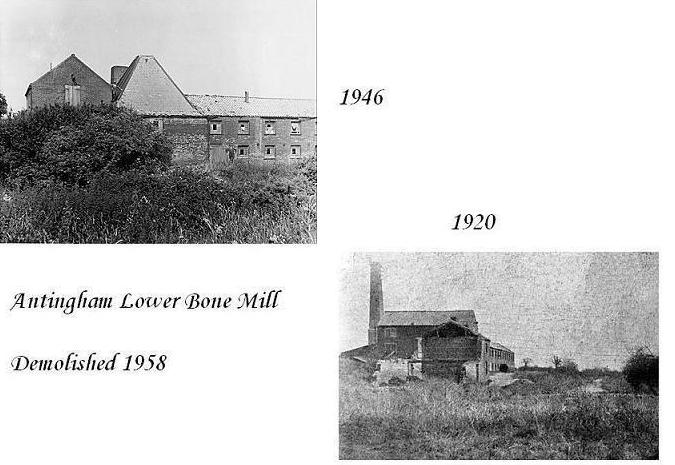
The Terminus and Antingham Lower Bone mills
On the 1885 map, an interesting arrangement is shown [45],
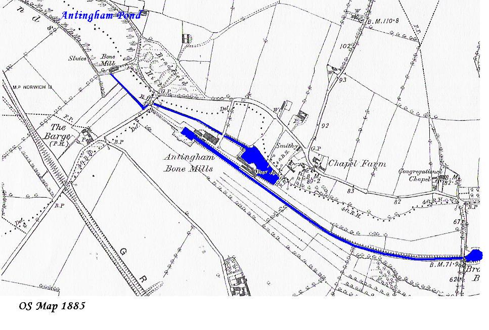
still ghosted in outline by the fence and field lines on the modern OS map. Antingham Pond was the “head of water” – basically the reservoir used to fill the canal- but was NOT actually part of the navigation or used for boats, and the terminus of the canal, on Lord Suffield’s land, was just south of the lane that runs beneath the foot of the pond (OS 266 324). The Barge Public House, on the 1885 map, now appears as Barge Farm [46]. The old footpath north from this, there in 1885 and still shown on the modern OS map, appears, sadly, to have been recently closed. My comment on this practice remains unprintable; it makes me feel that the era of “enclosure” is still going on, two hundred years later.
The original arrangement appears to have been that the terminus, a rectangular block of water just south of the road, was actually not ‘fed’ as such… but in the 1910 OS map and on the present one, there is a narrow blue line leading from the foot of the pond. This is still very much visible [47],
whereas the drain – I did dive into it to check – appears to be a dead end, and not fed at all from the Antingham pond side, although this is hard to see as there is now a very thick hedge preventing you from seeing what lies on the other side.
The drain, however, was in fact built to feed the shallow lake that once stood on the North bank, not far below the terminus [48].

When the lake was no longer required, and someone wanted to turn it back into a field, the drain was blocked up (1905) so no water would feed it. Simple. The shallow lake emptied, at its south-western corner, back into the canal – an important detail, as we shall see later.
The actual terminus of the canal is one of the spookiest places on its whole length. Approaching it southwards from the lane below Antingham pond, I was following a lovely, shallow stream that looks like it could almost carry a kayak with a few more inches’ depth [49]
until – suddenly, you are plunged into a pretty thick wall of foliage and a squelchy ditch starting up on the left hand side (north side) merges with your stream to become – something unearthly [50]. Breaking out of this at length a kind of stunted dwarf forest marsh opens up in front of you. This is the area still shown on modern maps as a plain, rectangular block of water (OS ). In its heyday it was more than big enough for a wherry to turn round, but the water now trickles and rushes its way across the bed in a totally random manner [51]. One thing is for certain; it looks nothing whatsoever like a rectangle of water. The terminus was apparently a very sizeable 80 x 150 feet. The “Norfolk Mills” website has aerial photos from the 70s that demonstrate the layout admirably.
[50]
[51]
Looking at the 1885 map again, there were two buildings on the North bank, just past the terminus. There is little enough left to show where these two buildings stood – they were demolished in 1958. Approaching down the “road” [52]

that once led to them, there appears nothing whatsoever to be left on the site [53].
It’s a lot of work, but scratching around further down in the undergrowth on the side of the canal bed unearths all that is left; a short ditch filled with what feels like brick rubble which once lay between the two buildings, and two fragments of wall which I reckon were not part of the buildings but a brick wharf built for the boats – unless the mills actually rose out of the canal themselves. The only surviving photos show the rear part of the mill so we can only speculate here.
Grubbing around in the side of the canal you now and again find yourself tripping over bricks and tiles and once, a fallen slab of wall – they are so mossy and overgrown it is easy to miss them.
As I mentioned earlier the “drain” came away from the feed channel from the pond, cut right through the lane (there is no bridge) and led under the bone mill road/track (complete with a small, now very overgrown stone bridge) to a shallow staithe on the 1885 map which has now vanished (the story of all the staithes and lakes on the canal, so it seems!). Originally I concluded this was simply built to supply water power to the sluice and wheel I discovered at the end of this section, but the Norfolk Mills site provided the vital information that a fleet of boats was used to link the pond mill to this one, and this also helps to explain the presence of a “boat house” marked on the staithe . Evidence for this lies in the only other remaining fragment of brickwork I could find. It most likely provided water to work the long, thin bone mill found between the staithe and the canal. I scratched and stung myself to death wading into a whole wall of nettles on the offchance, but was at length rewarded for my pains, because this is now the largest remnant left of everything that went on here.[55]
It looks to me like a sluice with water steps on one side, [56]
and was I think the point on the 1885 map where the shallow staithe/lake fed back into the canal [57].
There are rusty metal plates on either side of the “channel” and a still standing archway [58]

at the bottom that must have had water going through it. Behind this would have stood the long, thin mill buildings marked on the map that appear to be labelled “boat houses”, but the staithe/lake and the “drain” that fed it were used for a fleet of small boats to communicate between the mill here and the upper mill at the foot of Antingham pond, so I wonder if this is where they were kept? A rusted iron wheel that looks like a traction engine drivewheel lies tantalisingly in the leaf mould. There’s stories oozing out of this fragment of building… if only bricks could talk. But it’s exactly where such a structure would have been. There is a photo of this on the Norfolk Mills website taken in the ‘70s when there was much less undergrowth around – my wheel was there! There’s also a photo of the arch, which appears to have sunk in a few extra inches of soil since then.
It is suggested that this was a wheel race (and the iron cross gudgeon wheel still lying there suggests this), so then this was probably another Mill building, driven by water. Certainly the two buildings up near the terminus, a short distance away may well have been just for storage; I think this other, long thin building was where the actual crushing went on, and the two black and white pictures from 1920 and 1948 do both show a long, rather sinister looking building [59].
This must be the same building, the actual Mill. It is recorded that a gas engine was later used, possibly after the ‘drain’ was blocked in around 1905. Fascinatingly, accounts conflict and the evidence is scarce as the complex has all but vanished without trace.
Something is puzzling me though – how did the drain, if it carried boats, cross the lane at the foot of Antingham pond? The drain isn’t deep enough for a bridge, unless there was one and it was demolished. After all, the road to the bone mills – now a farm track between two hedges – does still cross the drain by a small, ivied bridge… and how the heck did they get under this? It looks today to have all of two foot’s worth of clearance. With regard to the lane, presumably, before this there was a movable bridge, or more likely the two ends of the lane at the foot of Antingham pond just came to a stop either side of the drain channel? The 1885 map suggests both possibilities. It might even have been fordable.
I can’t really suggest much, except that what I demeaningly term “the drain” must actually at one time have been a quite deep cut channel with just enough headroom under the bridge(s) to clear a man sitting down on a boat. Or, the boats may have been simply drawn along from the bank anyhow.
Not much further down was the point where, to be honest, only mad people would continue as there is nothing much except marsh and not much water in this bit… from here down to Bradfield Bridge is just so much mud and silt and weed and reed. Maybe one day I would wade and hack it just to say I have done so, but as I said earlier, stand on Bradfield Bridge and you can see what it does.
Antingham Pond, Upper Bone Mill … and the source
That leaves only the source itself, now a short walk away. Above the feed channel for the canal [60]
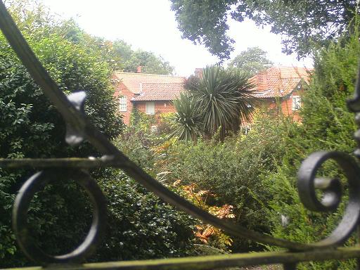
discussed earlier a handsome redbrick and tile building is visible. This is where the smaller, upper bone mill stood at the foot of the pond and it appears to still be there but built up into a sizeable house. Glimpse it from the channel on the road, or through the wrought iron gates of its driveway. An irony again going on here – what was probably a very common, accessible industrial building in the 1850’s is now a desirable, exclusive residence.
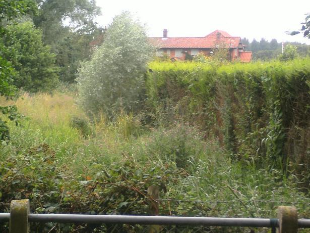
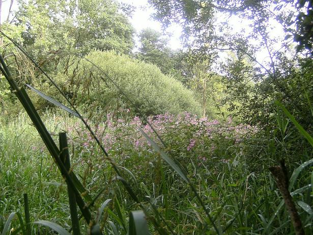
For the rest of the Pond, it is glimpsable through the hedge at intervals – it looks very much like any of the Broads with trees sweeping down to just a few inches above the water [61] - but the six-foot fence at the rear discourages would-be trespassers [62].

The next opportunity to rejoin the Ant happens just behind this at (OS ), as it emerges from under the lane [63].

Following the young Ant it takes you through some very lush and pretty woodland. If I’m honest I did what it seemed a few people have done i.e. taken little exploratory forays from the road as you go along – the pond marked at [64] wasn’t visible - until reaching the point where the lane crosses the Ant once more as it reaches its source on the north side, a beautiful meadow with an equally beautiful little wood [65].
Why do it?
Well there’s the Everest answer… because it’s there.
But there’s so much more. People have said to me, “There’s the Bure. It also has very beautiful surroundings, and it’s so much more visible! You don’t have to hack and bash and scratch yourself getting through it, you can walk along much more of it…” – well, I think that says it all actually! No more comment needed! The Bure is indeed a lovely river and my second favourite in Norfolk after the Waveney but the locks on it are paltry sluices by comparison with the Dilham Locks, and you get the feeling it wasn’t that much of a challenge to build. It doesn’t drop anywhere near as far as the Ant does; when I gaze into the cavernous depths of Ebridge or Briggate I wonder at the lengths that the people of North Walsham – or rather, the gentleman landowners whose brainchild it was – went to in order to do something to promote their town and link it to the Broads. I know some interesting old abandoned locks on the River Nene, one of which can be kayaked into down a forgotten side channel, and again, it’s fascinating because it’s old and disused… but the sense of depth and power isn’t there.
There also remains the fact that the Bure, even the private sections, meanders through quite open farmland. But the Sleeping Beauty analogy remains true throughout with the Dilham Canal; apart from the lowest section below the East Ruston arm turning, it remains securely tucked away in miles of reeds, nettles, grass, trees and shrubs and it’s not a light undertaking to follow it. Having done it I feel somehow closer to the canal, rather than just saying, “Oh well, that’s that then, what’s next?” and of course the inherent pathos of the canal’s history adds a three-dimensional feel as you look at this great White Elephant – or Green Elephant? – and wonder about it.
I have always gone with the old adage that your destination is nowhere near as important as the journey and that some journeys are well worth making even though the destination is pointless.
Whether walking, wading, swimming or kayaking, the Dilham Canal is just such a journey.
Returning to the issue of Bacton Lock again – a question, I said, was raised in my mind…
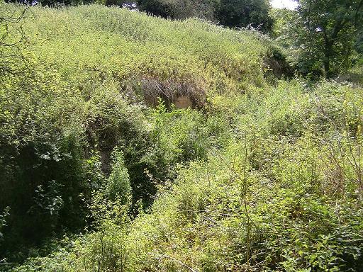
As we stand, the canal is at a precarious balance point. The lower mile or so is open, though still unspoiled. The upper 2 miles is un-navigable and largely buried in private land, and the intervening six miles or so, though nominally still in the hands of the canal company and therefore a public waterway, in practice is a very difficult and at times almost inaccessible route.
The question, therefore, is this: Can we keep the balance point from tipping? It seems we are partway down an axis that, at one end, has the possibility of the canal being wholly lost apart from the bottom section, and at the other, the spectre of total restoration which would see all the beautifully overgrown, crumbling locks restored to pristine red brick glory. To see the contrast in front of you, visit Bacton now while there is still some of the old lock side by side with the new [].
Which is your view on where, if anywhere, on this axis the canal should be fixed for posterity?
If I can advance my own – and I know this is unlikely to be the case – I would advise that Bacton continues to be restored thoroughly and is then kept as a working monument, the Dilham Canal’s answer to Vindolanda on Hadrian’s wall; as genuinely Roman as McDonald’s, but as authentic a reproduction of Roman building as you will see anywhere. However the clearing of the canal should perhaps proceed no further upstream than Briggate, so that the upper sections remain lost…? Or maybe the answer is to clear them more than they have been at present (which is not at all apart from the lock pound at Ebridge and Honing Staithe), but NOT as the wherries knew them – after all the delectably wooded sections of Broad we know today near Wroxham were not delectable at all in the 19th century when these were working waterways – any trees were ruthlessly felled to allow the wherry sails to fill with wind, and for timber for fuel and building.
It is always important to remember that our perception of waterways is very much that of the 1920s, when railways had long since superseded them and roads and motor transport grew in importance, while the world become ever more industrialised and men like Kenneth Grahame, Arthur Ransome and A.A. Milne were busy immortalising riverside life in images we still consciously call upon today – indeed subconsciously, for the river stories these men wrote were also stories designed for their own children, and generations including my own have imbibed the magic of the riverside without realising they were doing so. The waterways of England, especially Eastern England, ceased to be busy industrial/agricultural workways and became, in English thought, pleasant, poetical places to spend a lazy afternoon in a boat – and the Dilham Canal was prominent in this regard as it never achieved the success that its planners dreamed of and became a leisure attraction from the late 1860’s onwards [66]. If we think of the men and women of the 1830’s thinking of the Canal as we would now think of the M6 Toll Road around Birmingham, then we can approach the difference that has occurred in thought since then!
It would be a terrible shame to lose the whole thing to mud and weed, and I think that, luckily, this is unlikely to happen, even if the Sea Palling wall fails and the Eastern Broads are flooded from Horsey Gap (perish the thought – but it could well happen). The canal, essentially, is the upper Ant – and unlikely to disappear entirely.
Yet surely total restoration, all locks rebuilt, would be as great a shame? And what is the need for a wide, cleared waterway down which motor craft might undoubtedly one day travel? Let the ivy and the oaks and willows and the brambles keep their hegemony of the waterway; let there still be places only an agile and fit canoeist can pass… let the magic remain. I apologise to the canal itself for destroying some of that magic by hacking along it and by writing this book, but I redeem myself somewhat by saying that the enthusiasm that led me to slice through the walls of creeper and bramble that mask this sleeping beauty from the world do not lead me to call for the “restoration” of it – there are times when restoration equals vandalism, however well meant, and this is one of them. Also, I say with a wry smile that the canal is well able to look after herself and she will soon restore her marginally invaded modesty as soon as next year’s growth of brambles, weeds and grasses starts. She will pull the garments of nature back over herself quietly and firmly, and within a year or two you won’t know I was there.
Julie Griston’s book on the Canal is the only publication to discuss its possible future. She states that “the most popular solution would be a multi-purpose nature reserve”, with sections canoeable (fitted with slopes with rollers at the locks that would assist small boats but bar larger craft), sections reserved for fishing and some, with trails added, simply kept as nature reserves. She was concerned because, at the time, the IWA were talking about “easing Broads traffic” by clearing the whole thing for motor boats…
But we needn’t worry. To do so would be a million-pound job involving a huge amount of labour, and I fully endorse the views of locals that to extend the dirty, litter-strewn water of the Broads up into the pristine levels of the canal would be sacrilege and vandalism of the lowest sort. It would be just as bad to open the upper Bure above Coltishall or the Waveney above Geldeston, or indeed the Yare above Whitlingham; all these are small, secretive rivers that are, and should rightly continue, the haunts of the intrepid walker, canoeist/kayaker, fisherman and nature enthusiast or bird spotter. The crass mass tourism of the Broads has no place in ANY of these beautifully overgrown river reaches.
This mantle of overgrowth is actually, looking at photos from the 60s and 70s, a recent thing on much of the canal below Bacton. It is only since then that the encroaching vegetation has swallowed and claimed much of the route; there are pictures of Briggate Lock in the late 60s, complete with those upper gates I bounced up and down on still fixed in position, looking like you could go for a stroll off along the towpath, open banks and water stretching off towards the Weaver’s way bridge. In other words, not so long ago it could still give you a feel of what it must have looked like in the mid 19th century, how it looked when they made the 1885 map. Yet there is the sad description of Antingham Terminus in the 1890s – seventy years after it was built, in which a traveller describes rotting doors on rusty hinges, an air of gloom and desolation, deserted buildings… the canal rotted from the top down.
Please, let the canal stay more or less as is, and let us have no more talk of “opening up” – the canal is little known to the general Norfolk populace, let alone anyone outside the county and it seems fitting to keep it that way. If this book leads you to go off and explore, then all well and good…
But remember the future of the canal is in your hands as you do so.
EP
Bibliography
Ordnance Survey Map 1885 sheet XXIX, Courtesy Norwich Local History Library
Ordnance Survey Map 1910 sheet XXIX, Courtesy Norwich Local History Library
Ordnance Survey Map 1928 sheet XXIX, Courtesy North Walsham Library
OS Explorer map 25 North Norfolk Coast East 1:25 000 - 2008
Joby, R, “The North Walsham and Dilham Canal”, Klofron Publishing, Norwich, 1977
Malster, R; “Wherries and Waterways”, Terence Dalton, London 1986
Griston, J.; “The North Walsham and Dilham Canal”, 1981,
Press, M.: in 3 vols – E Allen review, “The North Walsham and Dilham Canal”, 1953
www.eawa.co.uk – East Anglian Waterways Association Website accessed Jan – July 2010. A good general all-round view of the canal with a selection of photos.
www.norfolkmills.co.uk – A fascinating website with probably the most information and photos anywhere on the Mills along the canal, including Antingham Bone Mills. You can find photos here, from the 60s -80s, of some of the lumps of masonry remaining that I found from the Terminus area.
An Act for making a navigable canal from the rivers Ant and Bure, at or near Wayford Bridge, near Dilham, to the towns of North Walsham and Antingham, in the county of Norfolk – 1812, George Eyre and Andrew Straham, p[1381]1439 George III year 52, ch 69
The Act
Holding and reading the waterstained 1812 print of the Act was an interesting experience – not least because it is kept in the safe room at Yarmouth library, an unlikely repository for such a document. It also took the assistants a fair while to locate it!
The Act is actually quite readable once your mind shifts over into the “f=s” mode (although I did still keep reading, “if this is the café, then”… and stopping to re-orientate myself).
So what are the surprises? The literature can tell you the tolls – basically manure, including lower grade lime, 2˝ d per ton per mile, Coke, pig iron, coal etc 3d per ton, up to wine and beer at 5d per ton. Passengers came in at 1d per mile at this stage.
Yes, the right is there in section 90 – and as far as I know has not been revoked – for craft unladen i.e. pleasure craft, to use the canal. Craft carrying less than 5 tons were not allowed to pass the locks until they had paid the minimum 5 ton fare. The minimum amount to charge by was a Ľ ton.
The power to set up steam engines is stated very early on.
Section II makes special mention that the heads of water that powered existing mills should not be in a worse state after building the canal than when the act was passed – yet towards the end is a requirement that (section XLV) compensation be paid to one Frederica Mariana Cecilia Windham, Thomas Taylor her tenant, and a John Joy, all of Dilham Staithe, before the work began.
There is an early protection of the vested interests of the Landowners, especially Charles Mills, who owned land on the west side of the Swafield road from North Walsham before the bridge. For the others, no wharfs, staithes or any other structures were to be built on or near their lands. It does strike me as curious that though this canal was for their (and their tenants’) benefit there were a number of men who, quite plainly, did not want anything “untoward” built on their land. They were named specifically to ensure this. Lord Suffield appears not to have cared – after all, two bone mills and a staithe were subsequently built on his. Also worth noting: Antingham “reservoir” was already in existence.
Section VII has a cute detail – The Sewer Commissioner’s Oath. “I, -------- do swear [Or: if the person is a Quaker, do solemnly affirm]…”
All proceedings were to be recorded in a book, kept for inspection by any person “at seasonable times”.
Section XLIX – Towing paths were to be fenced off. Interestingly, there is mention made of swing bridges to be set up if the canal cut through an estate larger than 10 acres to allow access to the sundered land. Tonnage bridge appears to have been built for this purpose as it is the only Dilham bridge that has no road going over it – yet it is the same as all the other bridges in design.
Section XVLIII – Millers were ordered to open/close their sluices as required to help in building the canal. If they didn’t they were given a stiff Ł20 fine. Again, we’re probably talking a modern Ł4,000 here. The interests of the Millers and the Canal owners – compatible as they may seem - evidently had undercurrents of trouble, because anothe r slim volume has been written about them, also in 1977 – John Kenneth Major’s “Conflicts of a canal and the millers”. It is notable that right from the start there are adjurations in the Act to the Millers and the Canal Company to play fair. Considering the canal spent much of its later life in the ownership of millers, first the Presses and then Cubbitt and Walker of Ebridge, this is particularly of interest.
Section LI - The canal proprietors were adjured to keep the canal in good repair. If they did not, the landowners could do so and charge the company.
Section LIV – The company were licensed, interestingly, to raise Ł30,000 so it appears that the canal was costed quite accurately from the start (remember it cost Ł32k to build). Each proprietor was allowed >1 and <20 shares. 600 shares were created, which were to be individually numbered, allocated and recorded.
Section LXIV – 15 persons elected by the proprietors were to be formed into a Committee of Management, for one year at a time. They were to meet at the Crown and Anchor Tavern in the Strand, London, on a Monday at 11pm, four times a year in November, February, May and August. (the time is later given as 12pm).
Section LXVI – The proprietors could appoint a treasurer. Any person or group of people with more than 400 shares could summarily appoint or dismiss this person. Worth noting, considering the fraud perpetrated by a treasurer in 1866, that security was supposed to be taken from the treasurer BEFORE he was entrusted with any monies…
Section LXXIII – Empowered the company to make its own byelaws, for the good behaviour of its personnel and conduct on the water. There was a maximum penalty of Ł5 for infringing them.
Section LXXVI – the bit that Edward Press contravened – that if any member of the management committee held any paid office or work under the proprietors he should be taken off the committee.
Section LXXXV – Any vessel giving a false bill of lading would be charged 40 shillings. Also any vessel staying anywhere longer than 48 hours would be surcharged.
Section LXXXIX – There would be “Collectors” who would monitor the tolls, and they were given the power to Stop and Search, re-weighing goods and making adjustments as required.
Section XC – The canoeist today can bear this one in mind; it may have lapsed but appears not to have been revoked. This is the one that sets up the canal as a free navigation for those not carrying any cargo. The “Liberty for any persons to navigate, on payment of tolls, to pass upon or use the canal”. The tolls were for goods and passenger carriage only.
Section XCI – This is a nice one. Again, pleasure craft were exempt but all other vessels were required to have clear ID painted on the Bow or Stern, in “Large white capital letters upon a black ground, at least 4 inches high” – every bit as specific as modern number plate regulations. Worth noting that there was also a Ł5 penalty for dumping rubbish in the water – modern travellers please note.
Section XCV – This requires Lock Keepers not to show partiality to certain vessels. This seems amusing – especially as only Honing ever boasted a Lock keeper – but it must have meant something, because the fine was a stiff Ł10, probably equating to a thousand pounds today.
Section XCVII – There was a 10 shilling fine for obstructing the canal with 4 shillings per hour that the boat was not moved after the owners were notified. At length the company could seize the vessel and move/remove it.
Section C – Locals could use the canal to shift their own corn and manure for free providing they did not pass a lock or a “stop gate”.
Section CI – Another interesting deviation. Half-mile posts were to be set up – “stones or posts” – purely, it seems , for measurement purposes in charging tolls although the reason is not given, just the order. Of course wooden posts may well have been set up! But there is no trace of any kind of stone marker. Or at least, one may be still sitting lurking in the undergrowth of the banks. If any landowners have one on the land that adjoins the canal I’d like to hear from them.
Section CV – This allows anyone else, as long as they were not damaging the canal, to build another canal to join it. This does seem to have happened at Little London. They had to be subject to the company’s tolls however.
Section CVI – All canal buildings were to be “rateable to the maintenance of the Poor”.
Section CIX – Preserved all existing Quarries and mines.
Section CX – Preserved the rights of fisheries. The canal company were not to be blamed for any fish that were destroyed as a result of being swept off into the canal however. Quite how that would be regulated I am not sure!
Appendix II
Table of distances
This turned up in a couple of sources, so I reproduce it here for your benefit. As I say, there should really have been ˝ mile stones to help you out. If you can find them, I’ll give you Ł10 (now, no going and marking your own stones, dumping them and photographing them).
From Wayford Bridge:
Honing: 2 miles 2 furlongs
Dee Bridge: 2 miles 4 furlongs
Briggate: 3 miles 3 furlongs
Ebridge: 5 miles and 1 furlong
Spa Common br.: 6 miles and ˝ furlong
Bacton Lock: 6 miles and 1 furlong
Austin/Royston Br.: 6 miles and 4 and ˝ furlongs
Swafield: 7 miles and 3 and ˝ furlongs
Antingham: 9 miles
Vessel sizes:
Length: 50’
Width: 12’ 4”
Draught: 3’ 6”
Headroom: 7’ 6”
There were a maximum of 20 wherries working the canal at any one time. Griston has a full table of these, their tonnages and last known skippers. The largest (and fastest) appears to have been the “Elizabeth”, at 27 tons. The smallest were several vessels at 18 tons each.
It’s worth noting that the remarkable Edward Press was an innovator: at the same time as a Mr Collins of Wroxham, he pioneered the age of water holidays and is credited as the first to remove Wherry hatches and replace them with glass – every standard Broads cruiser features this today.
Appendix III
Rights and Access
I would like to say, please don’t take any of this as a matter of “right”, even from Honing Staithe. Especially on the upper sections, I was discreet, alone, and usually early in the day; and I think you’ll find that that will serve you far better. Do NOT attempt to follow on foot on the canal banks – these are not only often impenetrable, but usually belong to somebody else. It’s the canal itself that’s free water, not its sides. Going as a twosome is probably good for safety, but remember also, this isn’t the stuff of big family outings, with loads of gear and dogs and young children. It is a seriously challenging hack for the fit and you should consider yourself to be as inconspicuous and as appropriately clad as possible. Make the country code your priority and keep out of sight of people’s private property. They don’t want to see you even if you do have a right to be there, so be considerate. If you’ve got to cut your way through, fair enough, but do only necessary clearing. Take secateurs, and gloves, and plasters. And remember: No-one but you is responsible for what happens to you!!!
As stated elsewhere, the company has never been wound up and so the canoeist’s advantage lies in two things; this state of limbo and the fact that enthusiasts are busy clearing this waterway every year from the lock points.
Essentially, up to Swafield Lower Lock, no-one can barge about ordering you off the water, quite simply because whatever they may think or assume, you are within your rights to use the water (if you are not carrying 5 tons of goods, and I’d love to see someone try). Clearing has been done at Honing staithe, well above the lock, with the expressly stated intention to open this up to canoeists, so carry on from here up to Bacton without qualm and with fortitude!
Above Bacton Lock you need to leave the water as the true canal is dry, and the water is a diverted stream on private land. Officially the “lost” path is inaccessible from either end… I leave it to your judgement as to what to do about this. All I’ll say is, there are plans mentioned on the EAWA website to install a permissive path to link up.
From Royston Bridge, you have footpath once more, but at Pigney wood this disappears and the canal becomes impossible to follow from the bank. Wading is the best option, done in summer, through to Swafield Bridge and up to the locks. Do take care though. Remember water levels change, particularly after storms, so if it starts getting scarily deep, stop. I also cannot advise wading the short section from Paston Way footbridge to Swafield Bridge, because I didn’t wade it…
As stated elsewhere, the next bit above Swafield Locks is totally inaccessible legally as this no longer belongs to the North Walsham Canal Company – it was decanalised in 1926 from 10 yards below the lock with the purpose of establishing sporting rights, but this never happened and instead the stretch from the top of the upper lock to Bradfield Bridge was bought in 1948.
And yes, leave the kids and dogs at home please. If they ever open up nature trails, then’s your chance.
Ed’s Plan for the Dilham Canal
Yep I said leave it alone!!
But… if people insist on messing with it:
Honing to Bacton: clear enough for canoeists, maybe down one side of the channel. Clear as much bank growth as necessary for this, but otherwise leave. No footpaths. Some fishing access, but not too much, with always a navigable route through. Maintenance of the locks as they are, with proper portage point added at Briggate.
Bacton to Pigney Wood: install those extra link footpaths they’ve talked about, and work with landowners to make this a linear nature reserve. Maybe some bird watching places? Royston Staithe to be converted into a nature reserve with hides etc.
Above Paston Way: this is again cleared for canoeists, and make sure they can access the water safely and easily above Royston, and get as far as Swafield. Again, Swafield Staithe ideal for nature reserve and a hide.
Swafield Locks: made over to the care of E Price!! No seriously, these too should be left as they are. Just as they are.
Section above Swafield Locks: ownership determined and if possible turned into fishing/nature reserve area with footpath added.
Up to the terminus: Install duckboard footpath from Bradfield Bridge to the ruins, which should be just cleared off enough to see. Info boards and pics on the Bone Mills. Exit via the old bone road.
Buy back Antingham Pond, and use for kayaks and small boats. Boat hire?? Visitor centre at the upper Bone mill… or rebuild the lower Mill!!
There you go!